| |
LA |
: |
Latitudes |
| LO |
: |
Longitudes |
|
| ME |
: |
Mountain heights |
| |
Grd_typ_S='GU' | : |
Global
Uniform
grid |
| Grd_typ_S='GY' | : |
Global
YinYang
grid |
|
| Grd_typ_S='LU' | : |
Limited area, Uniform |
| |
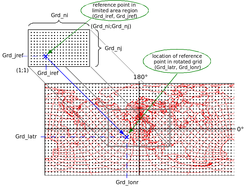
Grd_ni |
: |
total number of grid points in x-direction |
| Grd_nj | : |
total number of grid points in y-direction |
It is enough to specify the core number of points in y-direction as well as the "overlap" in degrees.
| Grd_nj | : | core number of grid points in y-direction | |
| Grd_overlap | : | overlap |
| |
Grd_ni |
: |
core
number of grid points in x-direction (including blending but excluding pilot area) |
| Grd_nj | : |
total number of grid points in
y-direction (including blending but excluding pilot area) |
|
| Grd_dx | : |
grid size in x-direction in degrees | |
| Grd_dy | : |
grid size in y-direction in degrees |
| |
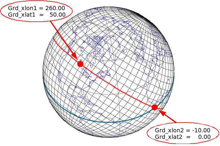
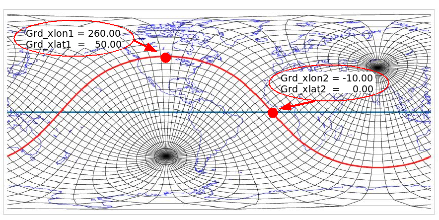
Grd_iref | : |
reference point in limited area region, x-grid coordinate |
| Grd_jref | : |
reference point in limited area region, y-grid coordinate | |
| Grd_latr | : |
location of reference point in "grid latitude" |
|
| Grd_lonr | : |
location of reference point in "grid longitude" |
| |
findfft | -min | : |
minimum number of grid points,
default 150 |
| -max |
: |
maximum number of grid points,
default
250 |