| |
LA |
: |
Latitudes |
| LO |
: |
Longitudes |
|
| ME |
: |
Mountain heights |
| |
Grd_typ_S='GU' | : |
Global Uniform grid |
| Grd_typ_S='GV' | : |
Global Variable grid |
|
| Grd_typ_S='LU' | : |
Limited area, Uniform |
| |
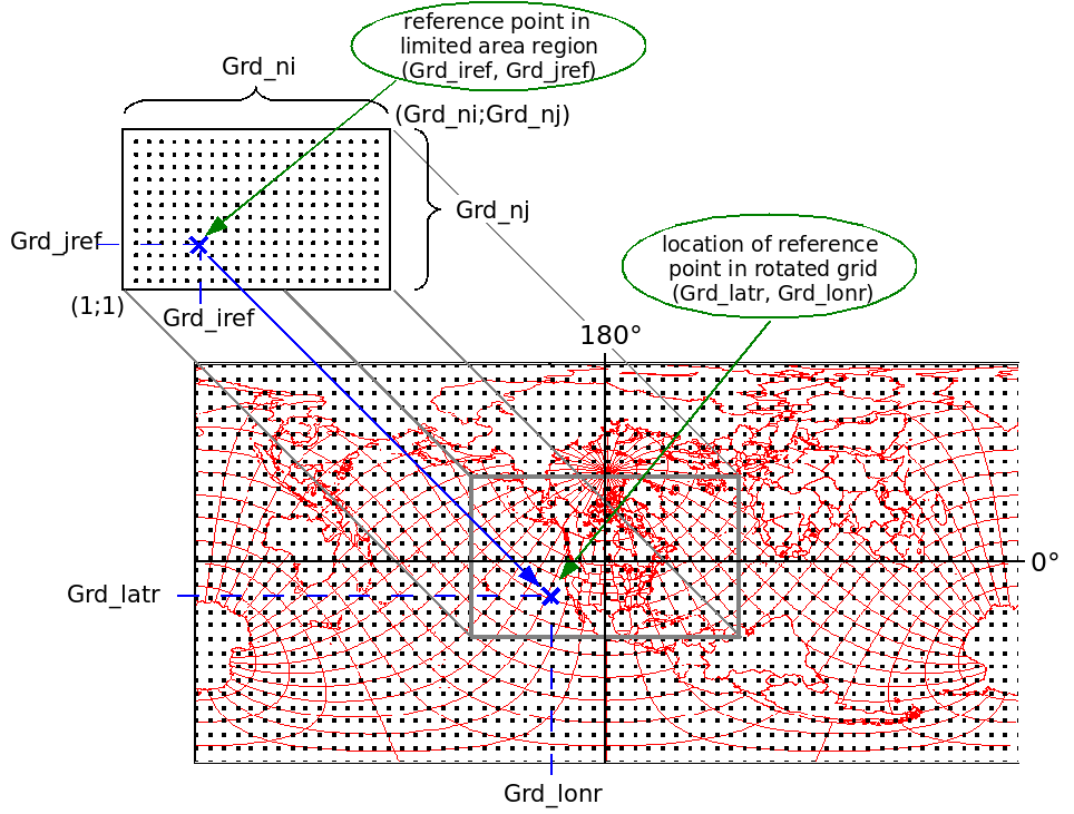
Grd_ni |
: |
total number of grid points in x-direction |
| Grd_nj | : |
total number of grid points in y-direction |
| |
Grd_dx | : |
grid size of high resolution area in x-direction in degrees |
| Grd_dy | : |
grid size of high resolution area in y-direction in degrees | |
| Grd_dxmax | : |
maximum resolution
in x-direction in degrees (optional) |
|
| Grd_dymax | : |
maximum resolution in y-direction in degrees (optional) |
| |
Grd_nila |
: |
number of grid points in high resolution area in x-direction |
| Grd_njla | : |
number of grid points in high resolution area in y-direction |
| r.diag makezg |
|
input_file
./output_file
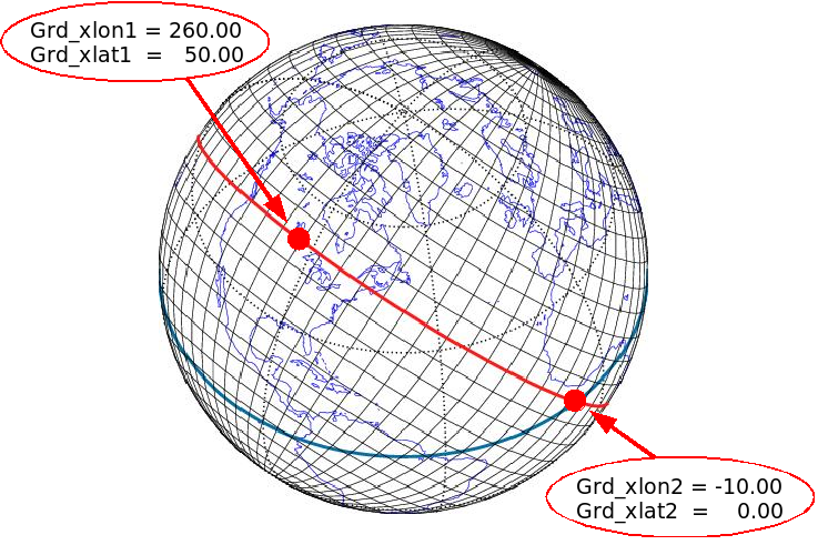
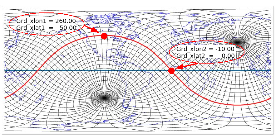
-kind =-1 -m Grd_dx [Grd_dxmax] -n Grd_dy [Grd_dymax] -dlon1 Grd_xlon1 -dlat1 Grd_xlat1 -dlon2 Grd_xlon2 -dlat2 Grd_xlat2 -i Grd_ni Grd_nila -j Grd_nj Grd_njla |
| |
Grd_ni |
: |
total number of grid points in x-direction |
| Grd_nj | : |
total number of grid points in y-direction |
| |
Grd_ni |
: |
total number of grid points in x-direction (including blending and pilot area) |
| Grd_nj | : |
total number of grid points in
y-direction (including blending and pilot area) |
|
| Grd_dx | : |
grid size in x-direction in degrees | |
| Grd_dy | : |
grid size in y-direction in degrees |
| |
Grd_iref | : |
reference point in limited area region, x-grid coordinate |
| Grd_jref | : |
reference point in limited area region, y-grid coordinate | |
| Grd_latr | : |
location of reference point in "grid latitude" |
|
| Grd_lonr | : |
location of reference point in "grid longitude" |
| |
findfft | -gnimin | : |
minimum number of grid points,
default 150 |
| -gnimax |
: |
maximum number of grid points,
default 250 |
||
| -cfl |
: |
put same value as for 'Pil_maxcfl'
and 'Step_maxcfl' |